Using this dataset, you can view all of the neighborhoods and zip codes in Philadelphia and how these regions overlap.
| Neighborhood | Primary Zips | Secondary Zips (If applicable) | Neighboring Neighborhoods | Nearby Neighborhoods | USPS Locale Designation |
| Academy Gardens | 19114 | 19136 | Aston Woodbridge, Morrell Park, Northeast Airport, Pennypack Woods, Torresdale, West Torresdale | Crestmont Farms, Franklin Mills, Holmesburg, Lexington Park, Millbrook, Modena, Normandy Village, Pennypack, Pennypack Park, Winchester Park | Torresdale |
| Allegheny West | 19132 | 19129 | East Falls, East Park, Glenwood, Strawberry Mansion, Tioga, West Park | Brewerytown, East Falls, Franklinville, Germantown Penn Knox, Germantown Southwest, Germantown Westside, Glenwood, Hartranft, Nicetown, North Central, Stanton, Strawberry Mansion, Tioga, Wynnefield Heights | North Philadelphia |
| Andorra | 19128 | 19444 | Upper Roxborough, Wissahickon Park | Cedarbrook, Chestnut Hill, Dearnley Park, Germany Hill, Manayunk, Mount Airy East, Mount Airy West, Roxborough, Roxborough Park, Wissahickon Hills | Roxborough |
| Angora | 19143 | Cobbs Creek, Squirrel Hill, Kingseeing, Cedar Park | Kingsessing | ||
| Ashton Woodenbridge | 19114 | 19136 | Academy Gardens, Northeast Airport, Pennypack, Pennypack Woods, West Torresdale | Bustleton, Crestmont Farms, Holmesburg, Lexington Park, Modena, Morrell Park, Pennypack Park, Rhawnhurst, Torresdale, Winchester Park | Torresdale |
| Avenue of the Arts North | 19122 | 19123, 19130, 19132 | Franklintown, Spring Garden, Poplar, Yorktown, North Philadelphia West, North Philadelphia East | Spring Garden | |
| Avenue of the Arts South | 19107 | 19102, 19107, 19121 | Center City East, Center City West, Midtown Village, Washington Square West | Philadelphia | |
| Bartram Village | 19143 | 19145 | Elmwood, Grays Ferry, Industrial, Paschall, Southwest Schuylkill | Cedar Park, Cobbs Creek, Garden Court, Kingesessing, Spruce Hill, University City, Walnut Hill, West Passyunk, West Powelton, Woodland Terrace | Kingsessing |
| Bella Vista | 19147 | Dickinson Narrows, Hawthorne, Passyunk Square, Queen Village, Society Hill, Washington Square | Center City, Chinatown, East Passyunk, Graduate Hospital, Greenwich, Newbold, Old City, Pennsport, Point Breeze, Rittenhouse | Penns Landing | |

We noticed this data is hard to come by, and for good reason: while postal codes are clearly defined, neighborhoods do not always have clear boundaries. In fact, some neighborhood boundaries are the subject of hot debate by residents and local organizations:
All that said, we saw a need for a reliable dataset that gives Philadelphians a starting point when working with neighborhood lists. This dataset was assembled by our Philadelphia-based analytics team using sites like Zip Data Maps, Academic.com, and Capitol Impact as references. In situations where neighborhood boundaries were unclear, we researched online for trustworthy evidence of true boundaries and made the best determination possible.
We are confident in our analytics team’s work, but we also recognize that this is a complex topic. If you notice any issues, please let us know.
This dataset can be used by anyone in or outside of the Philadelphia area working on reports, apps, or other projects that require neighborhood lists. Due to the complexity of this dataset, other analysts can also utilize this as a starting point to enhance or blend it with other datasets.
We utilize state-of-the-art AI and machine learning to enrich datasets further and provide predictive analytics for your important KPIs. Get in touch to learn more.
| Neighborhood | Primary Zips | Secondary Zips (If applicable) | Neighboring Neighborhoods | Nearby Neighborhoods | USPS Locale Designation |
| Academy Gardens | 19114 | 19136 | Aston Woodbridge, Morrell Park, Northeast Airport, Pennypack Woods, Torresdale, West Torresdale | Crestmont Farms, Franklin Mills, Holmesburg, Lexington Park, Millbrook, Modena, Normandy Village, Pennypack, Pennypack Park, Winchester Park | Torresdale |
| Allegheny West | 19132 | 19129 | East Falls, East Park, Glenwood, Strawberry Mansion, Tioga, West Park | Brewerytown, East Falls, Franklinville, Germantown Penn Knox, Germantown Southwest, Germantown Westside, Glenwood, Hartranft, Nicetown, North Central, Stanton, Strawberry Mansion, Tioga, Wynnefield Heights | North Philadelphia |
| Andorra | 19128 | 19444 | Upper Roxborough, Wissahickon Park | Cedarbrook, Chestnut Hill, Dearnley Park, Germany Hill, Manayunk, Mount Airy East, Mount Airy West, Roxborough, Roxborough Park, Wissahickon Hills | Roxborough |
| Angora | 19143 | Cobbs Creek, Squirrel Hill, Kingseeing, Cedar Park | Kingsessing | ||
| Ashton Woodenbridge | 19114 | 19136 | Academy Gardens, Northeast Airport, Pennypack, Pennypack Woods, West Torresdale | Bustleton, Crestmont Farms, Holmesburg, Lexington Park, Modena, Morrell Park, Pennypack Park, Rhawnhurst, Torresdale, Winchester Park | Torresdale |
| Avenue of the Arts North | 19122 | 19123, 19130, 19132 | Franklintown, Spring Garden, Poplar, Yorktown, North Philadelphia West, North Philadelphia East | Spring Garden | |
| Avenue of the Arts South | 19107 | 19102, 19107, 19121 | Center City East, Center City West, Midtown Village, Washington Square West | Philadelphia | |
| Bartram Village | 19143 | 19145 | Elmwood, Grays Ferry, Industrial, Paschall, Southwest Schuylkill | Cedar Park, Cobbs Creek, Garden Court, Kingesessing, Spruce Hill, University City, Walnut Hill, West Passyunk, West Powelton, Woodland Terrace | Kingsessing |
| Bella Vista | 19147 | Dickinson Narrows, Hawthorne, Passyunk Square, Queen Village, Society Hill, Washington Square | Center City, Chinatown, East Passyunk, Graduate Hospital, Greenwich, Newbold, Old City, Pennsport, Point Breeze, Rittenhouse | Penns Landing | |
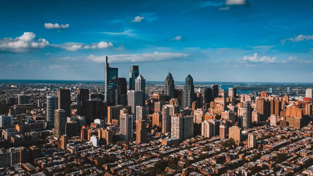
We noticed this data is hard to come by, and for good reason: while postal codes are clearly defined, neighborhoods do not always have clear boundaries. In fact, some neighborhood boundaries are the subject of hot debate by residents and local organizations:
All that said, we saw a need for a reliable dataset that gives Philadelphians a starting point when working with neighborhood lists. This dataset was assembled by our Philadelphia-based analytics team using sites like Zip Data Maps, Academic.com, and Capitol Impact as references. In situations where neighborhood boundaries were unclear, we researched online for trustworthy evidence of true boundaries and made the best determination possible.
We are confident in our analytics team’s work, but we also recognize that this is a complex topic. If you notice any issues, please let us know.
This dataset can be used by anyone in or outside of the Philadelphia area working on reports, apps, or other projects that require neighborhood lists. Due to the complexity of this dataset, other analysts can also utilize this as a starting point to enhance or blend it with other datasets.
We utilize state-of-the-are AI and machine learning to enrich the datasets further and provide predictive analytics for your important KPIs. Get in touch to learn more.
If you have additional questions, or have a specific request for this dataset, contact our team at FourFront.
Glenside, PA 19038