About This Dataset
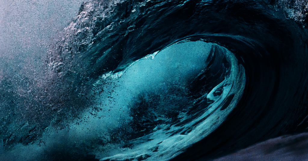
This dataset provides helpful information about popular surfing spots in California. Each location is identified by longitude and latitude location details. Of particular usefulness is the ability to sort through these spots based on ideal conditions like swell direction, wind direction, tide, wave quality, and more. This allows you to quickly find somewhere that’s working on the current conditions at any given time.
Although there are many great surfing locations in the US, we selected California because of its 840-mile coastline, which provides some of the best breaks in the country. The resulting dataset contains information on spots as far up north as Point St George in Crescent City down to Black’s beach near San Diego. Our team collected and cleaned the data in order to provide the most useful dataset possible.
Data sources: NOAA.gov; WannaSurf.com

Sample Data  Scroll table horizontally to view more
| ID | Zone | Location | Latitude | Longitude | Address | Zip | Wave_quality | Wave_type | Wave_direction | Wave_bottom | Wave_power | Swell_direction | Wind_direction | Swell_size | Best_tide_position | Best_tide_movement |
|---|---|---|---|---|---|---|---|---|---|---|---|---|---|---|---|---|
| 1 | Del Norte | Crescent City South Beach | 41.7457683 | -124.174884 | South Beach, Crescent City, CA 95531, USA | 95531 | Normal | Beach-break | Right and left | Sandy | Not Found | Not Found | Not Found | Starts working at Less than 1m / 3ft and holds up to 2m+ / 6ft+ | Mid and high tide | Rising tide |
| 2 | Humboldt | Big Lagoon | 41.1604014 | -124.1336821 | Big Lagoon, CA 95570, USA | 95570 | Normal | Beach-break | Right and left | Sandy | barrel | NorthWest, West, SouthWest | East | Starts working at Less than 1m / 3ft and holds up to 2m+ / 6ft+ | Low tide only | Not Found |
| 3 | Sonoma | Omar shereef | 38.291859 | -122.4580356 | Sonoma, CA 95476, USA | 95476 | Normal | Reef-rocky | Right | Reef (coral,sharp rocks etc..) with sand | barrel | NorthWest, West, SouthWest | East, NorthEast | Starts working at 1.0m-1.5m / 3ft-5ft and holds up to 3m+ / 10ft+ | Mid and high tide | Rising and falling tides |
| 4 | San Francisco | Ocean Beach | 37.7593921 | -122.510734 | Ocean Beach, San Francisco, CA, USA | 94122 | Regional Classic | Beach-break | Right and left | Sandy | barrel | Not Found | Not Found | Starts working at Less than 1m / 3ft and holds up to 4m+ / 12ft | All tides | Not Found |
| 5 | Santa Cruz | 26th Ave. | 36.9604257 | -121.9788819 | 26th Ave, Pleasure Point, CA 95062, USA | 95062 | Regional Classic | Beach-break | Right and left | Sandy with rock | barrel | NorthWest, West, SouthWest | East, NorthEast | Starts working at 1.0m-1.5m / 3ft-5ft and holds up to 4m+ / 12ft | Low and mid tide | Rising and falling tides |
| 6 | Santa Cruz | Greyhound Rock | 37.0588228 | -122.2767313 | Greyhound Rock State Marine Conservation Area, Davenport, CA 95017, USA | 95017 | World Class | Reef-rocky | Left | Flat rocks with sand | barrel | North, NorthWest, West, SouthWest, South | North, NorthEast | Starts working at Less than 1m / 3ft and holds up to 4m+ / 12ft | Low and mid tide | Rising and falling tides |
| 7 | Monterey | Point Sur | 36.3063643 | -121.9016398 | Point Sur Lighthouse, Monterey, CA 93940, USA | 93940 | Regional Classic | Sand-bar | Right and left | Sandy with rock | rippable | NorthWest | SouthEast | Starts working at Less than 1m / 3ft and holds up to 2.5m+ / 8ft+ | Low and mid tide | Falling tide |
| 8 | San Luis Obispo | Moonstone | 41.0301251 | -124.1095121 | Moonstone, Westhaven-Moonstone, CA 95570, USA | 95570 | Normal | Beach-break | Right and left | Sandy with rock | Not Found | Not Found | Not Found | Starts working at Less than 1m / 3ft and holds up to 2.5m+ / 8ft+ | All tides | Rising and falling tides |
| 9 | Santa Barbara | Main Street | 34.4208305 | -119.6981901 | Santa Barbara, CA, USA | 93102 | Normal | Beach-break | Right and left | Sandy | barrel | NorthWest, West, SouthWest | East | Starts working at Less than 1m / 3ft and holds up to 2m+ / 6ft+ | All tides | Rising and falling tides |
| 10 | LA County | Sunset | 34.0953512 | -118.3723783 | Sunset Blvd, California, USA | 90069 | Regional Classic | Point-break | Right and left | Reef (coral,sharp rocks etc..) with sand | mushball | West, SouthWest | East, NorthEast | Starts working at Less than 1m / 3ft and holds up to 2m+ / 6ft+ | Mid tide | Rising and falling tides |
Who Is This Data For?
This dataset is best suited for surfers looking for the best surfing spots along the California coast. It may also be useful to those working in the surfing industry who are looking for unique, accurate data in order to create unique content, to build surfing related applications, or to enrich other surf-related projects.
- Identify the best surfing spots
- Train a surfing-related AI tool
- Create unique content for a surfing audience
Enrichment Options
We utilize state-of-the-art AI and machine learning to enrich datasets further and provide predictive analytics for your important KPIs. Get in touch to learn more.
- Expand the dataset to include information for other regions
- Blend with other data
Data Enrichment
Additional Questions?
Sample Data  Scroll table horizontally to view more
| ID | Zone | Location | Latitude | Longitude | Address | Zip | Wave_quality | Wave_type | Wave_direction | Wave_bottom | Wave_power | Swell_direction | Wind_direction | Swell_size | Best_tide_position | Best_tide_movement |
|---|---|---|---|---|---|---|---|---|---|---|---|---|---|---|---|---|
| 1 | Del Norte | Crescent City South Beach | 41.7457683 | -124.174884 | South Beach, Crescent City, CA 95531, USA | 95531 | Normal | Beach-break | Right and left | Sandy | Not Found | Not Found | Not Found | Starts working at Less than 1m / 3ft and holds up to 2m+ / 6ft+ | Mid and high tide | Rising tide |
| 2 | Humboldt | Big Lagoon | 41.1604014 | -124.1336821 | Big Lagoon, CA 95570, USA | 95570 | Normal | Beach-break | Right and left | Sandy | barrel | NorthWest, West, SouthWest | East | Starts working at Less than 1m / 3ft and holds up to 2m+ / 6ft+ | Low tide only | Not Found |
| 3 | Sonoma | Omar shereef | 38.291859 | -122.4580356 | Sonoma, CA 95476, USA | 95476 | Normal | Reef-rocky | Right | Reef (coral,sharp rocks etc..) with sand | barrel | NorthWest, West, SouthWest | East, NorthEast | Starts working at 1.0m-1.5m / 3ft-5ft and holds up to 3m+ / 10ft+ | Mid and high tide | Rising and falling tides |
| 4 | San Francisco | Ocean Beach | 37.7593921 | -122.510734 | Ocean Beach, San Francisco, CA, USA | 94122 | Regional Classic | Beach-break | Right and left | Sandy | barrel | Not Found | Not Found | Starts working at Less than 1m / 3ft and holds up to 4m+ / 12ft | All tides | Not Found |
| 5 | Santa Cruz | 26th Ave. | 36.9604257 | -121.9788819 | 26th Ave, Pleasure Point, CA 95062, USA | 95062 | Regional Classic | Beach-break | Right and left | Sandy with rock | barrel | NorthWest, West, SouthWest | East, NorthEast | Starts working at 1.0m-1.5m / 3ft-5ft and holds up to 4m+ / 12ft | Low and mid tide | Rising and falling tides |
| 6 | Santa Cruz | Greyhound Rock | 37.0588228 | -122.2767313 | Greyhound Rock State Marine Conservation Area, Davenport, CA 95017, USA | 95017 | World Class | Reef-rocky | Left | Flat rocks with sand | barrel | North, NorthWest, West, SouthWest, South | North, NorthEast | Starts working at Less than 1m / 3ft and holds up to 4m+ / 12ft | Low and mid tide | Rising and falling tides |
| 7 | Monterey | Point Sur | 36.3063643 | -121.9016398 | Point Sur Lighthouse, Monterey, CA 93940, USA | 93940 | Regional Classic | Sand-bar | Right and left | Sandy with rock | rippable | NorthWest | SouthEast | Starts working at Less than 1m / 3ft and holds up to 2.5m+ / 8ft+ | Low and mid tide | Falling tide |
| 8 | San Luis Obispo | Moonstone | 41.0301251 | -124.1095121 | Moonstone, Westhaven-Moonstone, CA 95570, USA | 95570 | Normal | Beach-break | Right and left | Sandy with rock | Not Found | Not Found | Not Found | Starts working at Less than 1m / 3ft and holds up to 2.5m+ / 8ft+ | All tides | Rising and falling tides |
| 9 | Santa Barbara | Main Street | 34.4208305 | -119.6981901 | Santa Barbara, CA, USA | 93102 | Normal | Beach-break | Right and left | Sandy | barrel | NorthWest, West, SouthWest | East | Starts working at Less than 1m / 3ft and holds up to 2m+ / 6ft+ | All tides | Rising and falling tides |
| 10 | LA County | Sunset | 34.0953512 | -118.3723783 | Sunset Blvd, California, USA | 90069 | Regional Classic | Point-break | Right and left | Reef (coral,sharp rocks etc..) with sand | mushball | West, SouthWest | East, NorthEast | Starts working at Less than 1m / 3ft and holds up to 2m+ / 6ft+ | Mid tide | Rising and falling tides |
Who Is This Data For?
This dataset is best suited for surfers looking for the best surfing spots along the California coast. It may also be useful to those working in the surfing industry who are looking for unique, accurate data in order to create unique content, to build surfing related applications, or to enrich other surf-related projects.
- Identify the best surfing spots
- Train a surfing-related AI tool
- Create unique content for a surfing audience
Enrichment Options
We utilize state-of-the-are AI and machine learning to enrich the datasets further and provide predictive analytics for your important KPIs. Get in touch to learn more.
- Expand the dataset to include information for other regions
- Blend with other data
Data Enrichment
Additional Questions?
If you have additional questions, or have a specific request for this dataset, contact our team at FourFront.


